閱讀繁體中文版
When bridges, trails and communications fail at the same time, is the familiar way back still an evacuation plan? The August 29 flash flood in Grand Canyon shows why knowing how to enter remote terrain is not the same as retaining a safe way out after conditions change.
Confirmed facts
The U.S. National Park Service reported that significant flash flooding began in Bright Angel Canyon and the Phantom Ranch area at approximately 2:30 p.m. on August 29, 2026. Nearly all footbridges across Bright Angel Creek were destroyed, while trails, facilities and the Transcanyon Waterline sustained major impacts.
NPS said 62 people had been evacuated from Phantom Ranch and the lower North Kaibab Trail by the morning of August 30. Arizona Department of Public Safety later reported that its Ranger 3 helicopter completed 13 flights on August 29–30 and transported 61 stranded hikers. The operation included short-haul rescue, hover extraction and FLIR-assisted searching. These figures reflect different reporting windows and should not be added together.
On September 1, NPS confirmed that two hikers had died and one member of their group remained missing. Associated Press reporting on September 3 said the search was continuing. This article does not speculate about responsibility or unpublished individual decisions.
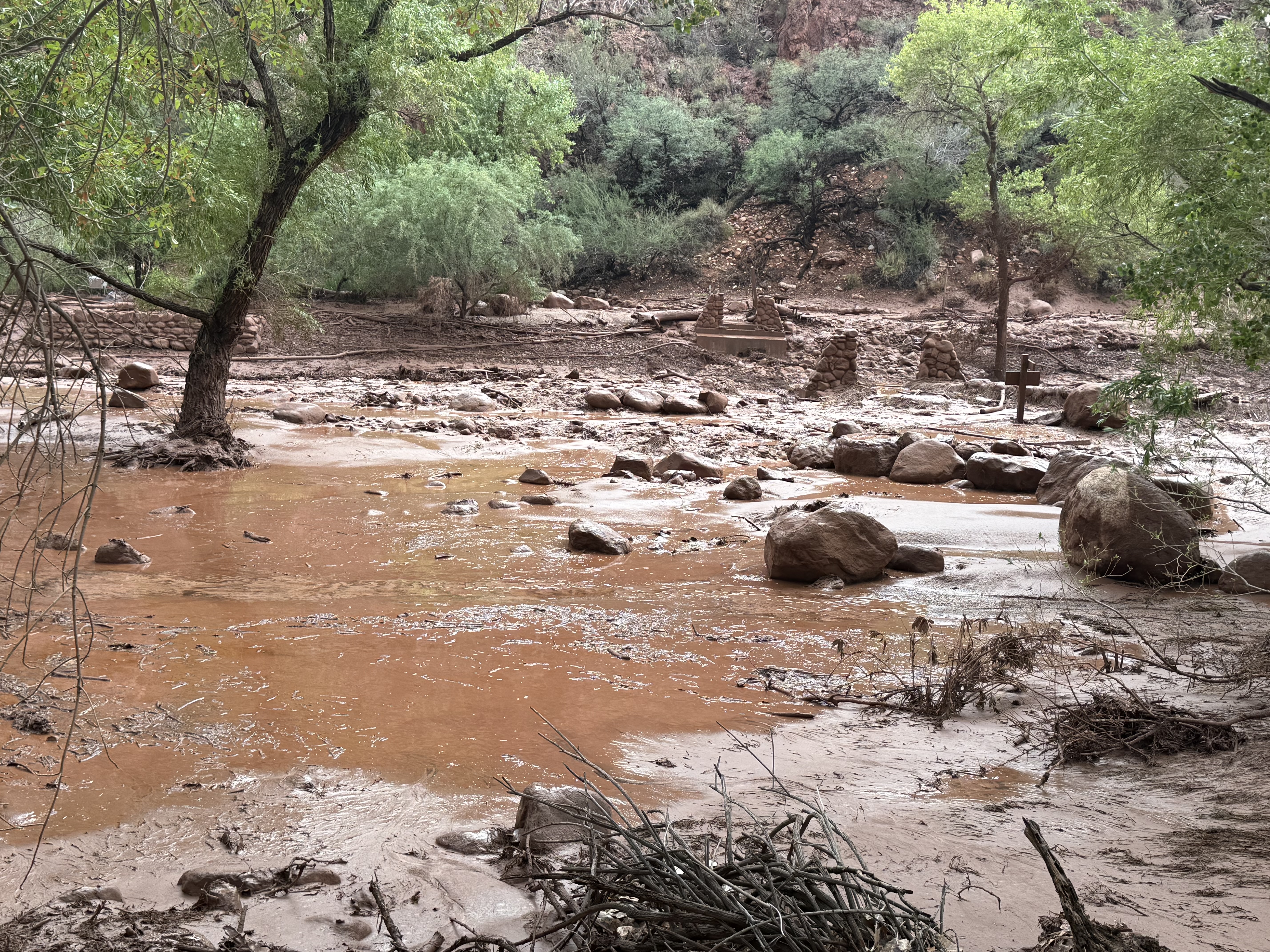
Image: National Park Service/J. Thompson, August 29, 2026. Used for factual event context.
Context
Bright Angel Canyon is deep, steep and inaccessible by road. Phantom Ranch and portions of the inner canyon are reached primarily on foot, by mule or with aviation support. When floods remove bridges and alter creek crossings, a planned itinerary can become a set of disconnected segments within minutes.
The practical lesson is not that more equipment guarantees safety. It is that route loss, personnel accountability and delayed outside support need to be part of the plan before a team enters remote terrain.
KTT Tactical Observation
1. The primary route is not a backup route
Reversing the original route still leaves a team with only one option. Flooding, rockfall, fire, road closure or bridge loss can make that option unusable. A real contingency plan identifies alternate high ground, safe waiting areas, locations visible to aircraft and clear triggers for stopping movement.
2. Accountability starts before search and rescue
Authorities used permits, vehicle information, itineraries and public tips to determine who might have been affected. A useful remote-travel plan includes names, intended routes, camps, entry and exit times, equipment descriptions, communication methods and a specific overdue threshold.
3. Communications need scheduled check-in points
Satellite messengers, PLBs and radios are tools, not automatic guarantees. Teams still need agreed check-in times, message formats, loss-of-contact criteria and a responsible outside contact. In a fast-changing event, the last confirmed location and time may be more useful than an imprecise live description.
4. Evacuation is a system, not a helicopter
This response combined aircraft, ground teams, short-haul techniques, FLIR, receiving points and post-evacuation support. Aviation can bridge some terrain gaps, but weather, visibility, payload, landing access and mission prioritization still apply. The plan must also cover survival, medical needs, signaling and group control while support is delayed.
Limits
Public information is still developing. A full rainfall record, warning timeline, individual decisions and complete casualty chronology are not yet available. The outcome cannot establish that one item of equipment or one route choice caused the event, and successful air evacuation does not mean aviation support will be timely or available in every similar setting.
This article is a risk-planning discussion. It does not replace official weather alerts, closure orders, qualified guides or rescue-agency instructions.
Discussion
If you could strengthen only one part of remote-trip preparation, which would you choose?
- A. Pre-identified high ground and stop points
- B. A complete itinerary and personnel-accountability record
- C. Scheduled satellite check-ins
- D. Better survival and medical capability while awaiting rescue
Sources
- U.S. National Park Service, August 30, 2026
- Arizona Department of Public Safety, September 1, 2026; updated September 2
- Associated Press, September 3, 2026
- U.S. National Park Service, September 1, 2026
Fact check completed September 4, 2026. Casualty and search information may change; consult later NPS updates.


